ABSTRACT
On average 75 billion tons of freshwater exit from Bhutan every year. Freshwater of the Himalayas is used for domestic purposes, to irrigate fields and to generate hydroelectricity among many other uses. Bhutan is perhaps one of the few countries rich in freshwater. The per capita share of freshwater may be one of the highest in the world. A Food and Agriculture Organisation (FAO) report mentioned that Bhutan’s per capita fresh water was 108,476, 557 liters in 2014 – the fifth highest in the world. Yet, the water on each person’s share is of little use, as they don’t get to use it. The methods and policies used in the past were effective in using water. Due to a shift in peoples’ lifestyle and habits, previous system of water management is not enough to meet their future needs. In all cases, water is redirected to rivers or evaporates into atmosphere directly. Here, an academic discussion is carried out on perspective of water use in Bhutan.
Keywords: erosion, fresh water, glacial lakes, hydroelectricity, irrigation, pollution
Introduction
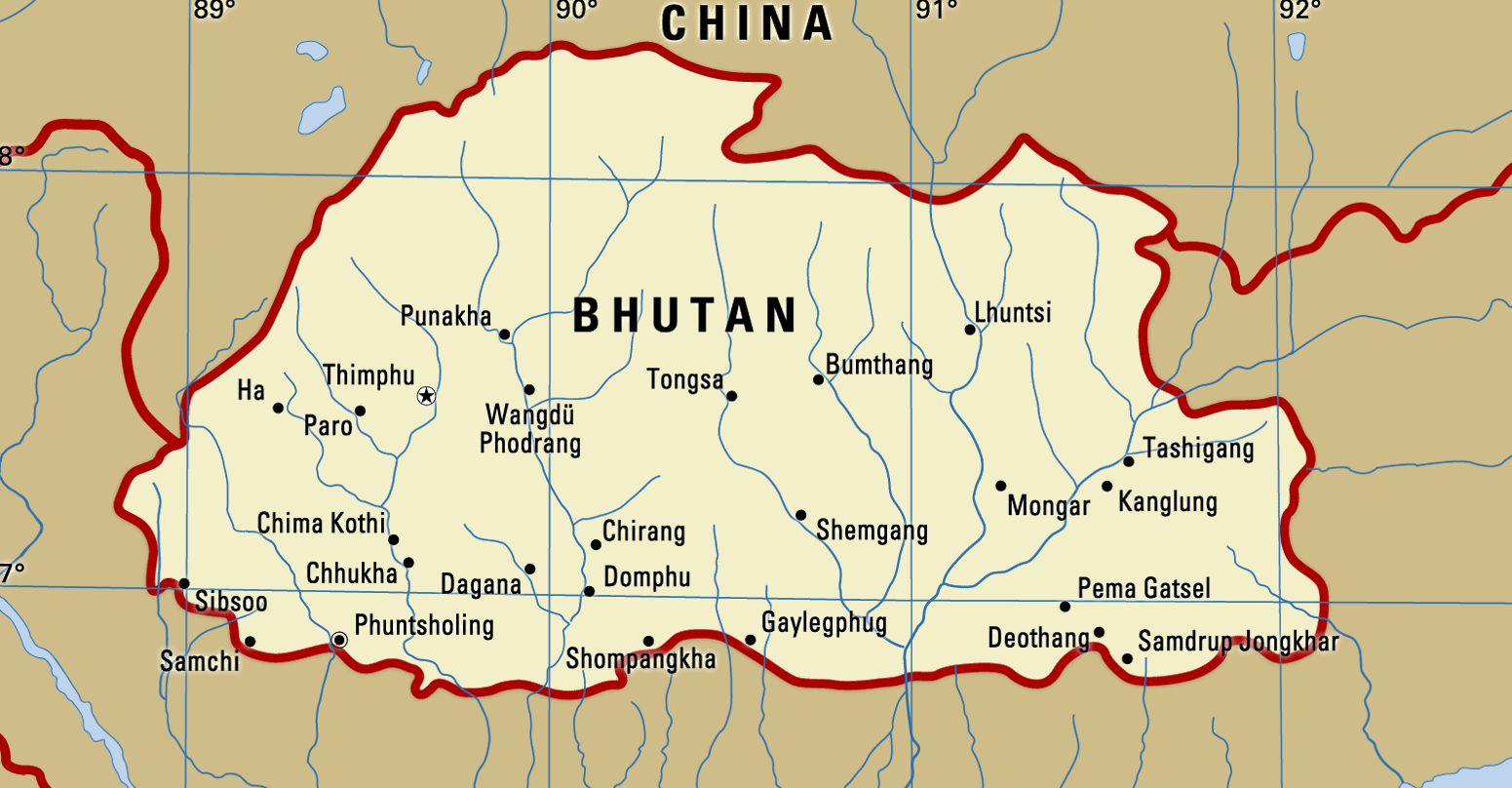
The Himalayas, of which Bhutan is part of, is a natural water condenser that converts water vapor into freshwater. Two factors, high altitude and continuous mountain ranges intercepting monsoon clouds help to complete water cycle. The tall mountains not only convert clouds into water that flows downhill as streams, rivulets, and rivers but also store water in the form of ice for slow release. Himalayan ranges within Bhutan have altitude from 97 m (318 ft) to 7,528 m (24,698 ft) above sea level. The aerial measurement is 305 km from west to east and 145 km from south to north (Dubey, 1978) with an area of 47,000 sqkm (Figure 1). However, approximately 8,500 sqkm is under stake with China and India leaving only 38,500 sqkm in government’s diplomatic references (Rizal, 2013). A report on water resources management plan by Royal Government of Bhutan (RGoB) mentions that an estimated 2,325 cbm/s of water flows out of Bhutan (RGoB, 2007). It accounts to 73,000 million cbm or 73 billion tons of water per year. Water resources include cloud harvest, glacier, glacial lakes, groundwater, lakes, rainwater, rivers, snow, soil moisture springs, streams, water, waterfall, wetlands, etc. All waters from Bhutan flow to India then to Bangladesh and end up in the Bay of Bengal. Clouds from the Bay of Bengal rise and fly to the Himalayas to get condensed into water or ice. Although, small by its area, five large and dozens of minor rivers flow from Bhutan heading to the Bay of Bengal.
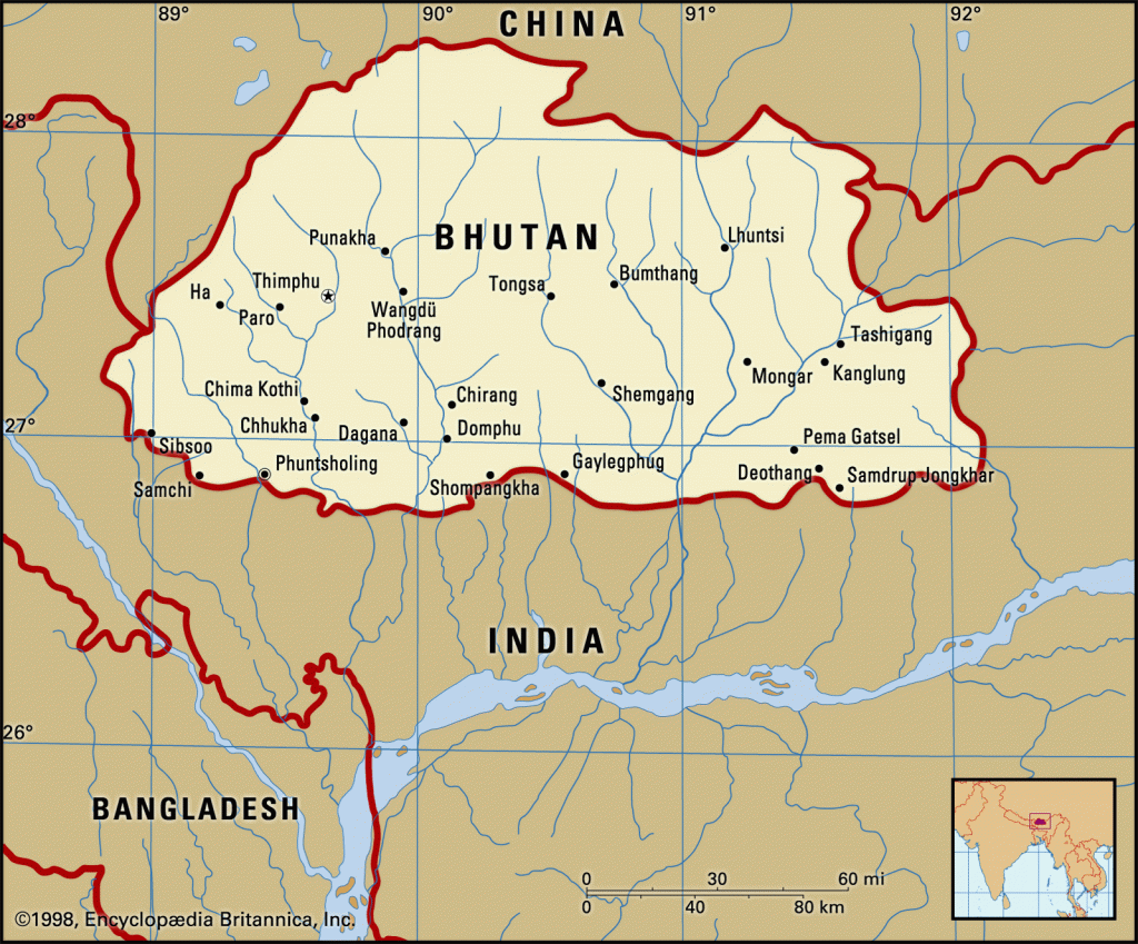
Sizes of the rivers depend on the height of the mountains, water catchment areas or sizes of glacial lakes. Some of the major (Ma), medium (Me) and minor (Mi) rivers based on their volume of water and perennial characteristics, located from west to east direction, include, but not limited to, the following: River Jaldhaka (Me); Sibsoo Khola (Mi); Dina Khola (Mi); Sukreti Khola (Mi); Dipu Khola (Mi); Dipojhora Khola (Mi); Chumurchi Khola (Mi); Torsa Nadi (Ma) tributaries include Wang Khola or Amo Chhu (Me), Ha Chhu (Me), Pa Chhu (Me), Wang Chhu (Me) and Thin Chhu (me); River Sunkosh (Ma) tributaries include Po Chhu (Me), Mo Chhu (Me), Dangchhu (Ma) Punatsang Chhu(Ma), Daga Chhu (Me); Sarbang Khola (Mi); Dholpani Khola (Mi); Leopani Khola (Mi); Bhur Khola (Mi); Seti Khare (Mi); Dhaula Khare (Mi); Mao (Aie) Khola; Lalai Khola (Mi); Taklai Khola (Mi); River Manas (Ma) tributaries include Tongsa Chhu (Mangde Khola); Dangme Chhu (Ma), Lhobrak (Me), Kulong (Me); Panbang Chhu (Mi); Maina Pokhari Khola (Mi); Dalasiri Khola (Mi); Kalanadi (Mi); Bada Khola (Mi); Lokhai Tora Khola (Mi); Samrang Khola (Mi); Jomo Tsangka Chhu (Mi); Galandi Khola (Mi); Bhairav Kunda Khola (Mi); and Dhansiri Khola (Me).
Uses of water
Water is life-sustaining gift of nature and rivers are the venues of civilization. In Bhutan, water-use is prioritised for domestic, agricultural, hydropower, industrial, and recreational purposes. The natural effects of the water and water-cycle sustain not just human civilisation but the survival of all the living organisms.
Domestic purposes
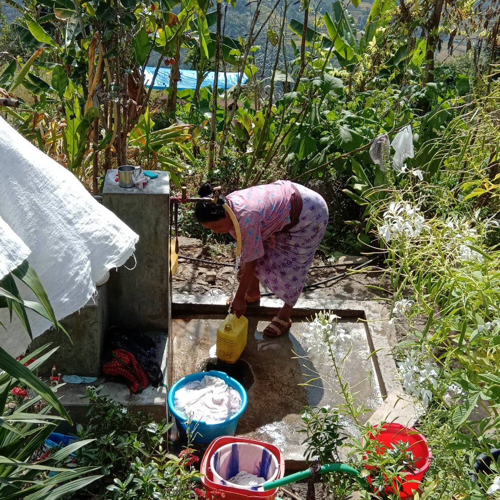
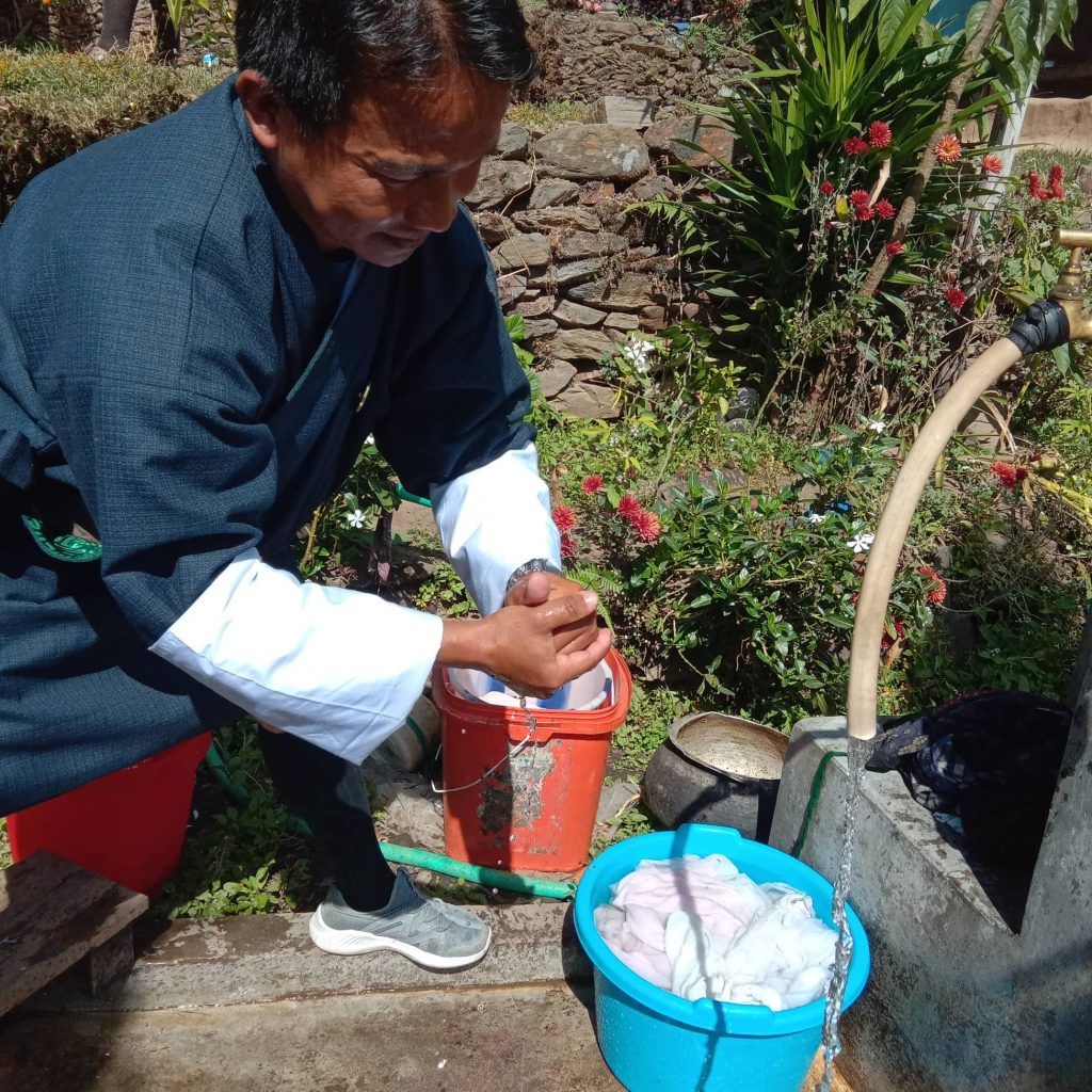
Water at home is used for drinking, cooking and washing (Figure 2). An increase in the per capita use of water has raised the sanitation standard and improved the general health of people. It’s also used for livestock for their drinking and sanitation. Freshwater fisheries and duckeries also use volumes of water as commercial fisheries rise.
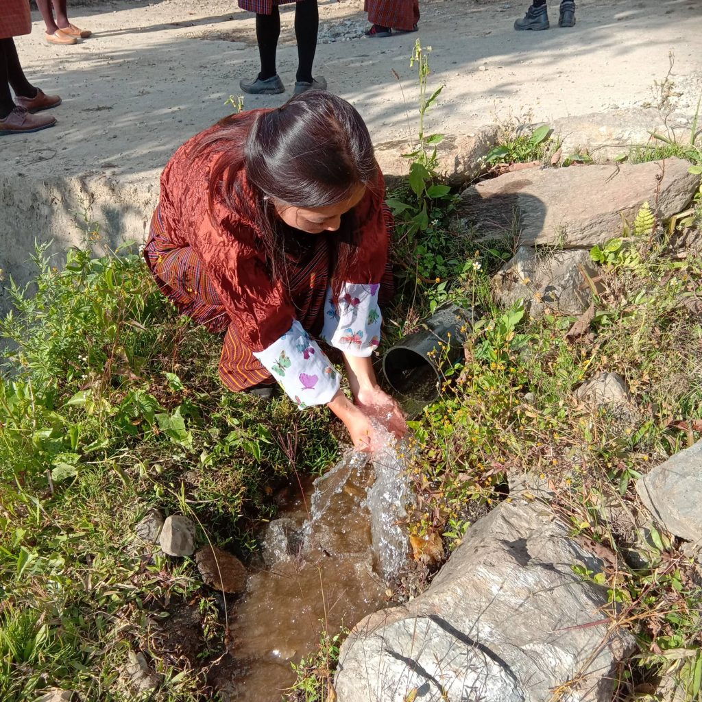
There is a shortage of water for supply in urban centers and improper distribution in rural areas. People in rural areas have often difficult but more access to drinking water compared to their urban counterparts (Figure 3). Until recent decades, urban hubs had better water supply which was one of the magnets of rural-urban migration. Now the situation is reversing.
Cities like Thimphu, Phuentsholing, Gelephu and Samdrup Jongkhar are facing water shortages. Concentration of population, development activities obstructing natural course of water are some of the causes of water shortages in urban centres. The water problems of Phuentsholing, or Gelephu are easier to solve. Big rivers flow besides those cities; more water from those rivers can be purified and added to the distribution system. Water in Thinchu river is limited to meet the water needs of Thimphu, the capital city. Water from distant glacial lakes must be drained into Thimphu’s water distribution system. It will cost money and time and warrant timely planning. The planners must consider ecological impact downstream of manually draining glacial lakes for city’s consumption.
Irrigation
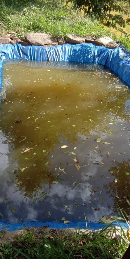
Drought and inadequate irrigation facilities are major factors affecting low yield in agriculture. Fields on mountains are poorly irrigated. They are monsoon dependent. Rain is limited to a few months of the year and land remains barren most time of the year. Focus on mountain irrigation and water harvesting technologies must be made extensive to reach the farmers. Rainfall dependent farming, poor conservation of water sources, drudgery in water collection, low yields from land are pushing factors of out-migration from rural areas, which in turn is leading to labor shortages in agriculture that in vicious cycle lead to the increase in cost of production and price rise. Rainwater harvesting in artificial ponds have started (Figure 4), but they are few and only used as models. They must be made extensive across the country.
Generation of electricity
Bhutan has harvested some benefit from hydroelectricity. Government of India (GoI) has been helping Bhutan in generating hydroelectricity and buying it. Hydroelectricity project harvesting water of river Jhaldhaka, at Jholung is perhaps the first example of a river of Bhutan used for electricity generation. Bridge over the dam connects roads of Bhutan and India. Today more than 76 sites are offered to India to convert water potential to electricity.
Hydropower resources contributed as high as 12% of the GDP in the 2000s (RGoB, 2006). It is estimated that Bhutan has potential to generate up to 30,000 MW of electricity and it has exploited less than 5% of the potential (Dorji, 2016). Even hydroelectricity is not without challenges. When water is channeled to turbines, natural water system is disturbed. Several natural sprouts have dried because their sources were directed or blocked with cemented walls. Of glaring example of is Punatshangchu I project.
In August 2019, heavy monsoon rain drained from mountains above Punatsangchhu river built up debris on artificial lake that burst from the pressure, sending water gushing down steep hillside.
Huge boulders were swept into the flooded zone. Bridges and plants were washed away. As the water joined big Punatsanchhu river, it caused chaos downstream. A block in the river flooded the main highway.
The redirected river swamped an equipment storehouse belonging to one of the contractors of struggling Punatsangchhu-II hydropower project. About US$110,000 worth of equipment was washed away .
Water-based tourism and recreation
Water-based tourism is attractive and has minimum disturbance on environment and natural water flows. Rafting, kayaking, swimming and canyoning are attractive adventure. Bhutan has not yet tapped this opportunity. Bhutan’s rapid rivers are assets for ages. National parks along the rivers avail aesthetic value to people and the environment. They are rare spots for sightseeing. Bhutan has huge potential to make use of the natural resources for this alternative as the major source of national income without having major impact on natural course of the water sources. The country is yet to harvest this potential.
Transportation
Bhutan’s water is least used for transportation. It may be difficult for two-way, but they are the best for one-way transportation. The rapid waters of major rivers can be used to transports goods of export like fruits, stones or finished products. They can reduce the transport cost during exports.
Roads or highways are constructed parallel to a river. Roads constructed on the banks along the water line are shorter than the snaky mountain roads. River thus provide shortest route that connects major cities if they are connected by a river.
Boundaries
Rivers are also used as natural boundaries at national, zonal, district, blocks, villages and farm levels. On the far west of Bhutan is river Jaldhaka, part of it forms the boundary between Bhutan and India. In the far east the river Dhansiri separates India and Bhutan. Borderlines of most districts pass through rivers, streams or the water-dividing lines along with the mountain ranges.
Challenges
Major challenges posed by fast-flowing rivers, high-altitude lakes and erratic rainfall are soil erosion, landslides, flash floods and destruction of land and properties. Water has become rarer than ever before (Figure 5). Climate change has magnified the adverse effects.
Water quality
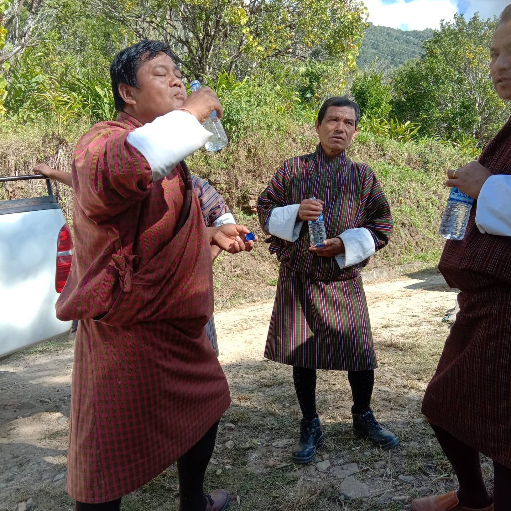
There are a few studies conducted and reports published on water quality. Those few reports are limited to quality assessment of water in urban areas. A report on Physico-chemical and biological parameters carried out at upstream, within the urban area and downstream in and around Thimphu urban area from 2008 to 2009 provides a hint. It showed that as water flowed downwards there was an increase in water alkalinity (pH), electrical conductivity, total dissolved solids, turbidity, nitrate, phosphate, chloride, total coliform, biochemical oxygen demand, but a decrease in dissolved oxygen (Giri and Singh, 2013). Use of bottled drinking water is getting popular in the country for its ease in carrying and quality (Figure 6).
There is a need to carry out extensive evaluation of water quality across the country. The quality of water going to homes and fields must be studied, and necessary precautions taken on time. Testing quality in drinking water supplied to residential area is important to understand the waterborne diseases and their control.
Soil erosion
Bhutan receives heavy rainfall for a few months – June to October. The rest of the year is mostly dry with scanty winter rainfall. Heavy rainfall washes topsoil, causes flood and landslides. On one hand, there are a few systems in place to harvest rainwater for later uses; on another hand loss of fertile topsoil causes poor crop performance. To get a proper yield, farmers are compelled to buy expensive chemical fertilisers. Use of chemical fertiliser has reduced in recent years when the government announced moving to organic farming, yet erosion of topsoil remains the concern for future agricultural yields.
Glacier outburst
Glaciers cover almost 10% of Bhutan’s land (Dorji, 2016). Most rivers in Bhutan source their water from glaciers and glacial lakes high up the Himalayas. As many as 2,674 glacial lakes of various sizes have been mapped. At least 24 glacial lakes are potentially dangerous (RGoB, 2006). They are feared to burst at any time. Bhutan was least prepared when such a glacial lake busted in 1994.
On 7 October 1994, Luge Tsho- a glacial lake busted causing a flash flood and a massive landslide in the downstream. The flash flood dumped fishes and aquatic animals on land beyond the riverbanks and took away land, properties, animals and people into the water. (For details, see Climate Change Impact in Bhutan by I P Adhikari)
Seasonal variation
Seasonal variation and irregular rainfall across the year have caused availability of crops for a short time only. Food production is limited to a few months. It has caused fluctuation in food supply and prices. Food imports show an increasing trend. Proper use of free-flowing water, construction of short and long irrigation channels, harvesting for prolong use of rainwater can help alleviate farmers’ problems. Cultivation season can be extended, production enhanced, supply and price fluctuation reduced. Ultimate benefit goes to national economy.
Solution to the seasonal variation on availability of water is the use of glacial water and lakes. They slow-release water which flows into rivers. Slow release can be used in fields and for other purposes.
Climate change
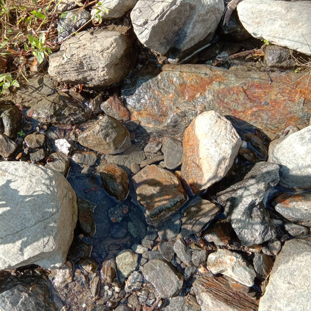
Climate change and blame on it has been an easy answer if not a pretext to negligence in conservation practices. Natural major and minor water sources are neglected. When water distribution using pipes started, traditional canals are replaced. Natural reservoirs are no more filled. Urbanisation and cutting down of trees above the water sources have led from temporary to permanent drying of water sprouts (Figure 7). Climate change may be the culprit, but lack of conservation efforts are its catalysts.
Pollution
Pollution as by-product of urbanisation and industrialisation has no brake at sight. They increase together giving a suffocating threat to plant, animal and aquatic lives. Pollution causes several health issues to human, livestock, aquatic lives, plants, animals and environment. It jeopardizes sustainable practices of agriculture, health and environment. Its increase triggers frequency and scale of man-made or natural catastrophes.
Water politics
Bhutan’s water-use politics are limited to Bhutan and India. Two governments RGoB and GoI had a sequence of dialogues on the use of Bhutan’s water in favor of Bhutan-India relationship. RGoB had three requests to the GoI that in turn had two. The Bhutanese side proposed the GoI to
a) Help RGoB keep away its dissidents in exile from reaching Bhutan,
b) Retain the direct descendants of Trongsa Penlop Ugyen Wangchuk as the guardian to Bhutan’s administration and natural resources, and
c) Develop infrastructure for the use of water resources.
In return, GoI wanted to be the ultimate authority to decide the market and policy for electricity generated from Bhutan; and keep the master switches of hydel projects in India. The discussion took a shape between 2000 and 2009.
1) A framework of agreement in 2001 between two governments on cooperation in hydroelectricity sector agreed that GoI built and purchase 5,000 MW of electricity by 2020.
2) A Power System Master Plan jointly prepared by experts of the two countries in 2004 estimated the potential of Bhutan to be 30,000 MW with production ability of about 120, 000GWh.
3) The Electricity Act was passed during the 79th session of erstwhile National Assembly of Bhutan in 2001. Department of Power (DoP) that was under the Ministry of Trade and Industry was restructured. The DoP was divided into three sections, Department of Energy (DoE), Bhutan Power Corporation (BPC) and Bhutan Electricity Authority (BEA) in 2002 (Department of Hydropower and Power System, 2008). The DoE was moved under the Ministry of Economic Affairs, and BEA acts as a liaison institute of GoI in Bhutan. The BPC has the role to contain internal dissatisfaction of the people and stakeholders, and to regulate the system. BPC has an influence on National Environment Commission (NEC) that provides environmental clearance to projects. Its influence also spans the Ministry of Agriculture (MoA) in regulating its activities to ensure sustainable watershed management. The alignment shows that power sector receives higher priority than agriculture.
4) In 2003, Power System Master Plan that classified five types of projects ranging from micro to megaproject schemes, listed 76 projects, 70 on rivers and six on reservoirs with a plan to harvest 23,760 MW before 2022.
5) In 2006, Tala Project of capacity 1020 MW was commissioned raising the electricity harvest to 1488 MW.
6) On 1 January 2008, three independent hydropower corporations handling Chuka, Basochhu and Kurichhu were merged into one Druk Green Power Corporation.
7) GoI has agreed to import a total of 10,000 MW from Bhutan by the year 2020. It’s expected to raise the revenue for the country.
Water policies
RGoB has shown a significant presence in international front in expressing the concerns of water and environment. Bhutan is signatory to several international legal instruments such as Basel Convention on the Control of Transboundary Movements of Hazardous Wastes and their Disposal; Cartagena Protocol on Biosafety to the Convention on Biological Diversity; Convention on Biological Diversity; Convention on International Trade in Endangered Species of Wild Fauna and Flora (CITIES); Kyoto Protocol to the UN Framework Convention on Climate Change; Statute of the Centre for Science and Technology of the Movement of Non-Aligned Countries and other Developing Countries; Statutes of the International Centre for Genetic Engineering and Biotechnology; UNESCO World Heritage Convention; International Plant Protection Convention (Adherence); UN Framework Convention on Climate Change; United Nations Convention on the Law of the Sea (RGoB, 2007), among many other treaties directly or indirectly related to water use and conservation.
However, Bhutan lags in framing national policy specific to water use and conservation. Several policy papers do incorporate those issues. Bhutan Electricity Act, 2001; Environment Assessment Act, 2000; Forest and Nature Conservation Act, 1995; Land Act, 1979; and Municipal Act 1999 are few acts that span the policies on the use of water and policy regulations. The RGoB had developed the country’s National Adaptation Program of Action (NAPA) in 2006.
Conclusion
Water is common property of all organisms on the planet. Everyone must understand it morally, conserve it naturally and use it rationally. All water users and stakeholders must participate to develop National Best Water Use Practice and adhere to it strictly. Bhutan can present itself as the model of best practices in management of water resources. This will supplement Bhutan’s much talked environmental conservation practices, globally.
References
Department of Hydropower and Power System, (26 June 2008). Bhutan sustainable hydropower development policy 2008. Ministry of Economic Affairs, Royal Government of Bhutan, Thimphu
Dorji, Y. (2016). Water: securing Bhutan’s future. Asian Development Bank, National Environment Commission. Royal Government of Bhutan, Thimphu
Dubey, G.P. (December 1978). Survey of the waters of Bhutan, physiography and fisheries potential, Food & Agricultural Organisation. Retrieved from http://www.fao.org/3/L8853E/L8853E02.htm
Giri, N and Singh, O.P. (January to June 2013). Urban growth and water quality in Thimphu, Bhutan. Journal of Urban and Environmental Engineering, 7: 82-95.
Rizal, G. (2013). Bhutan-China border mismatch. Bhutan News Service. Retrieved from http://www.bhutannewsservice.org/bhutan-china-border-mismatch/
National Environment Commission (2007). Bhutan water policy. Royal Government of Bhutan, Thimphu.
National Environment Commission (2006). Bhutan National Adaptation Programme of Action. Royal Government of Bhutan, Thimphu.
[1] Beldangi, Jhapa, Nepal
2 thoughts on “Waters of Bhutan”
Comments are closed.